We left the Falkland Islands behind us and headed south into the infamous Drake passage. I was on the RRS John Biscoe, heading eventually to the South Orkney Islands, but depositing first, scientists and other support personnel, in various locations on the Antarctic Peninsula.
Very few cruise ships visited the Antarctic in 1982, I was extremely lucky, and very excited to be visiting some remote locations before I disembarked at my final destination: Signy Island (a British Antarctic Survey research station).
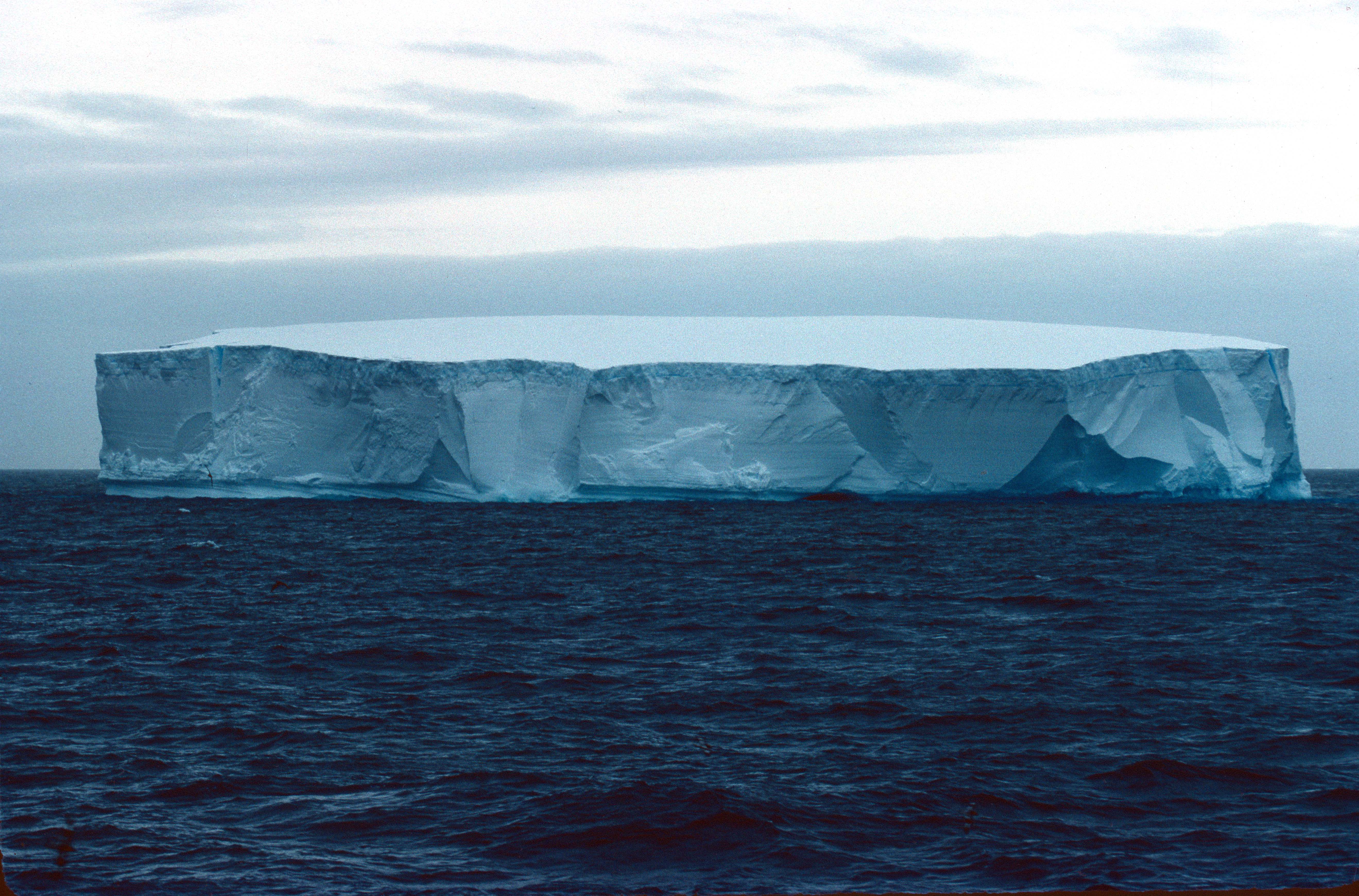
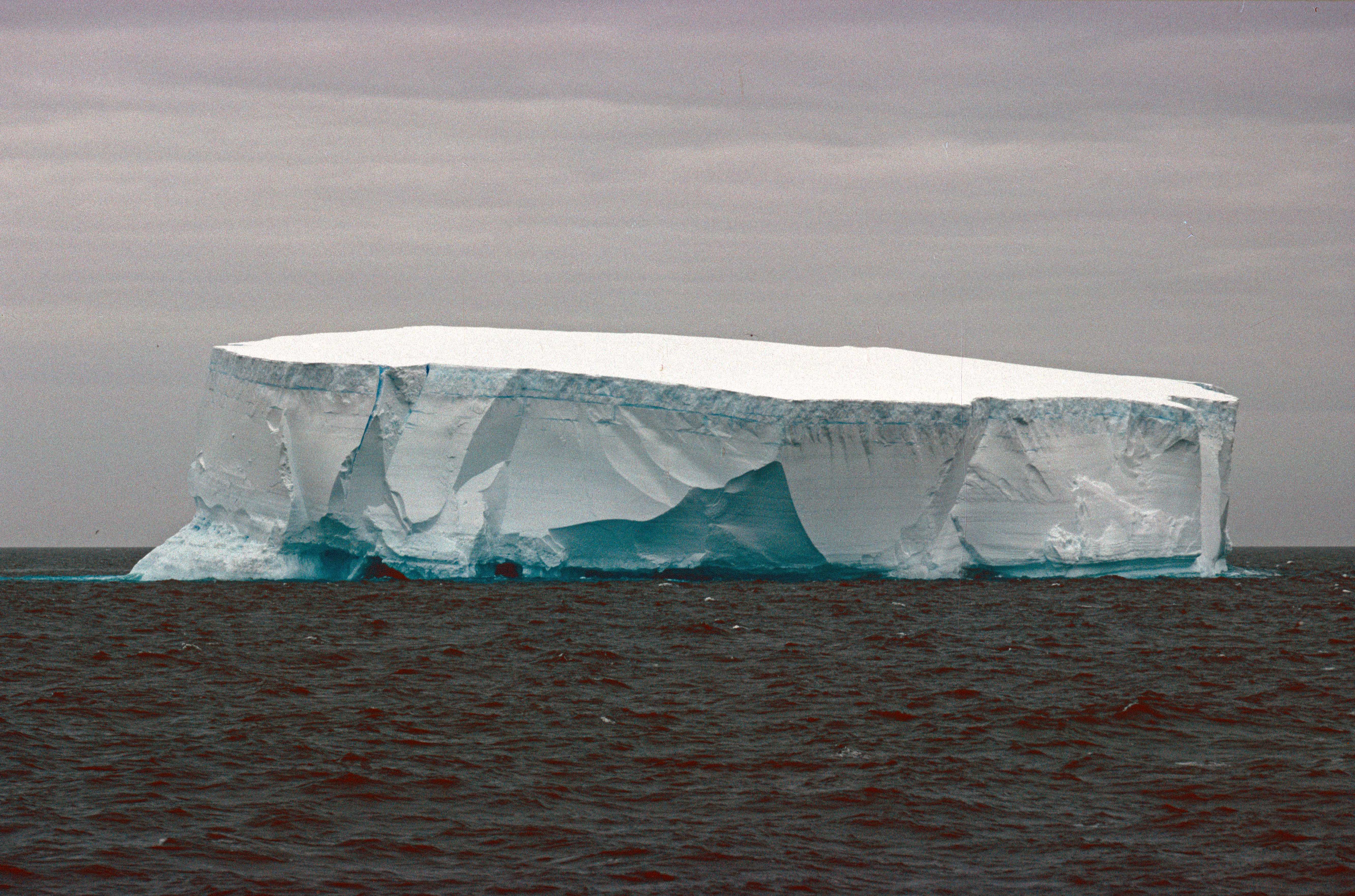
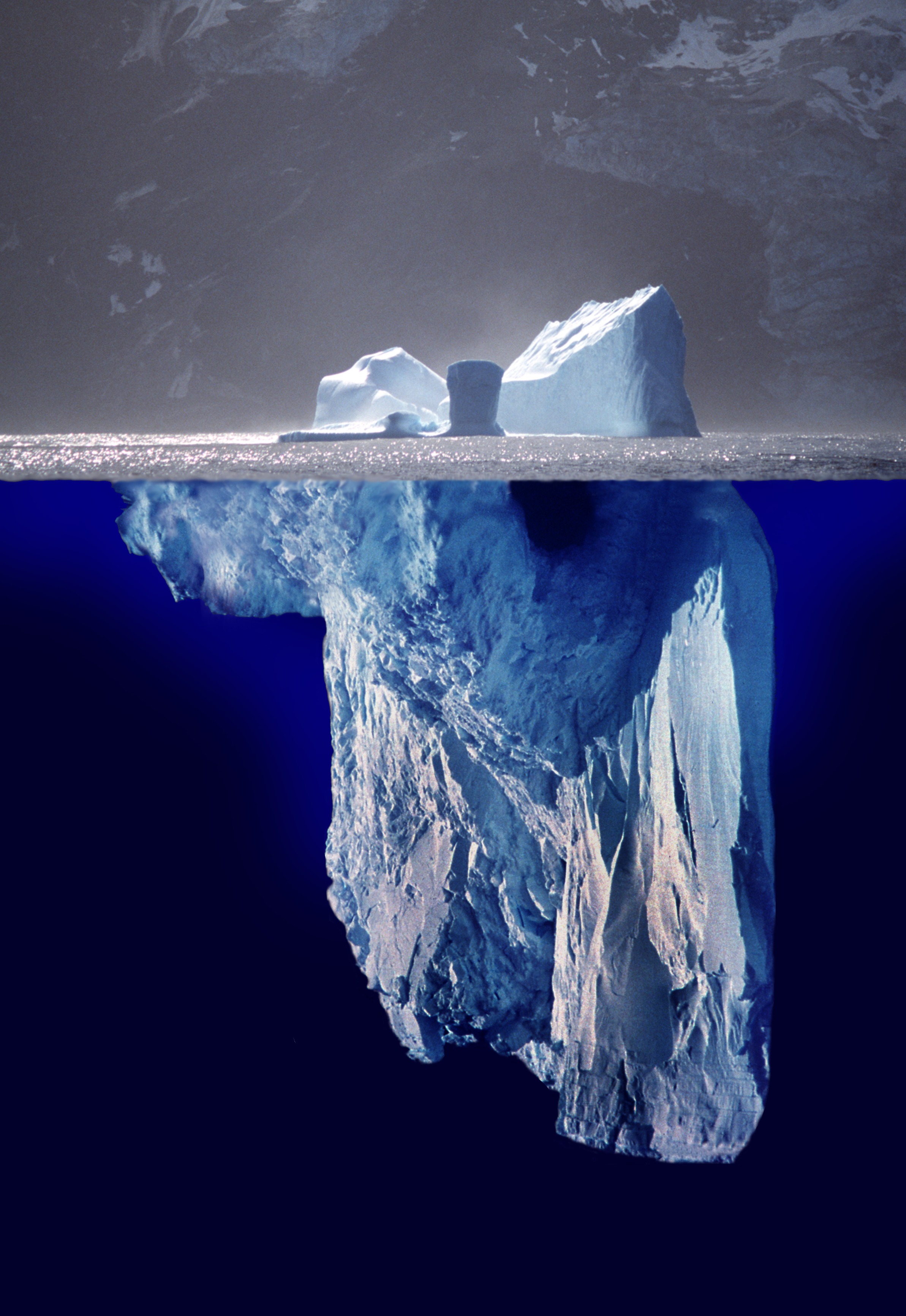
We were heading due south, towards the tip of the Antarctic Peninsula. The weather was kind to us on the crossing and we were able to pass fairly close to a number of icebergs. Seeing an iceberg for the first time is very exciting, and everybody – apart from some of the older hands, perhaps – rushed out on deck clutching cameras. A lot of photographs are taken of the first few icebergs, then gradually, one learns to accept that they will be a constant feature of your life as you head further south! The vast majority of an iceberg is underwater, of course, as this amazing photomontage (below) by Prof. Dr. Uwe Kils, illustrates.
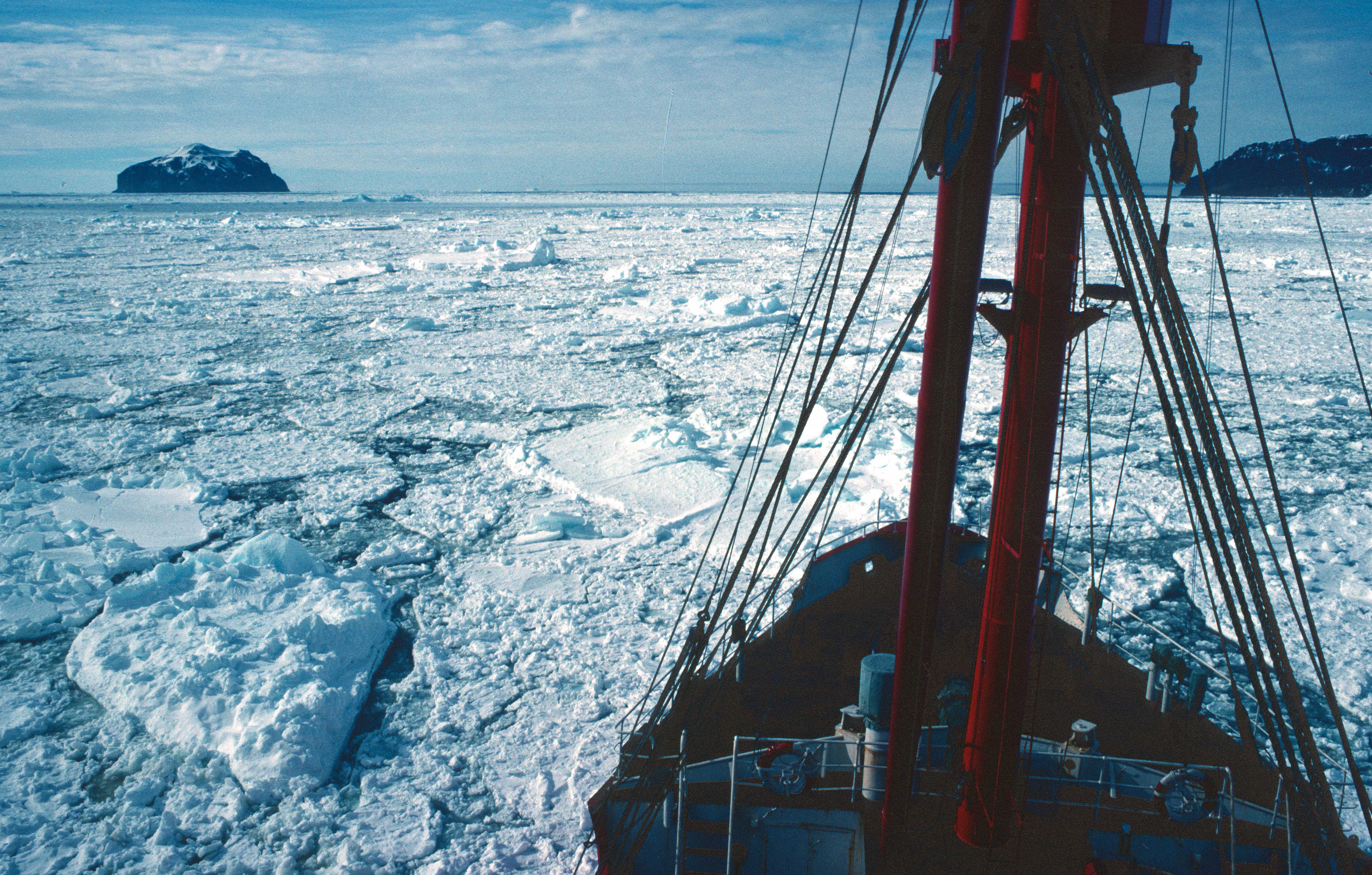
We sailed down towards Antarctic Sound, at the very tip of the peninsula, an area called Trinity Peninsula (see map below). We were heading to James Ross Island to drop off a field party of geologists, who were going to spend the austral summer working there.

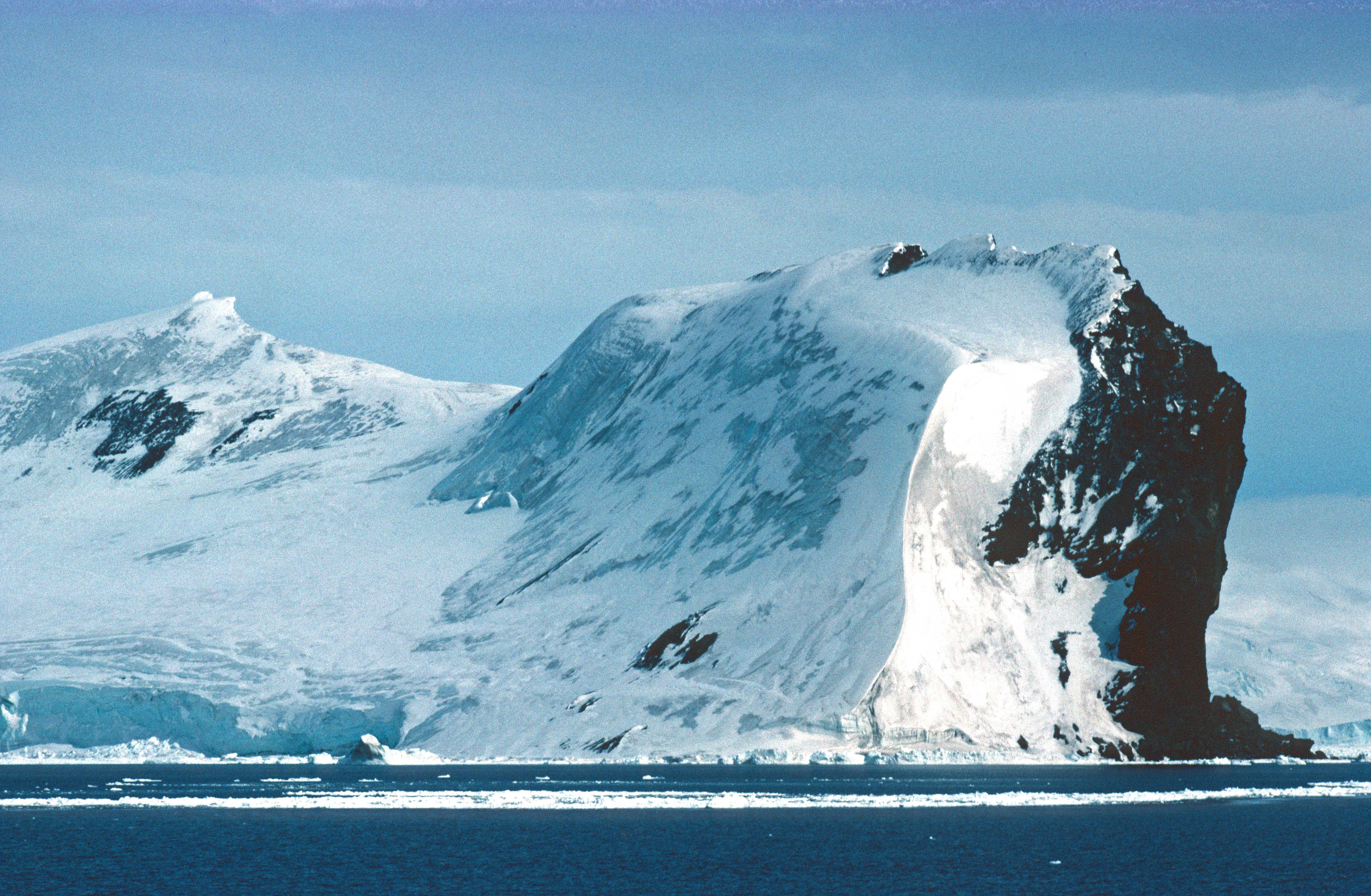
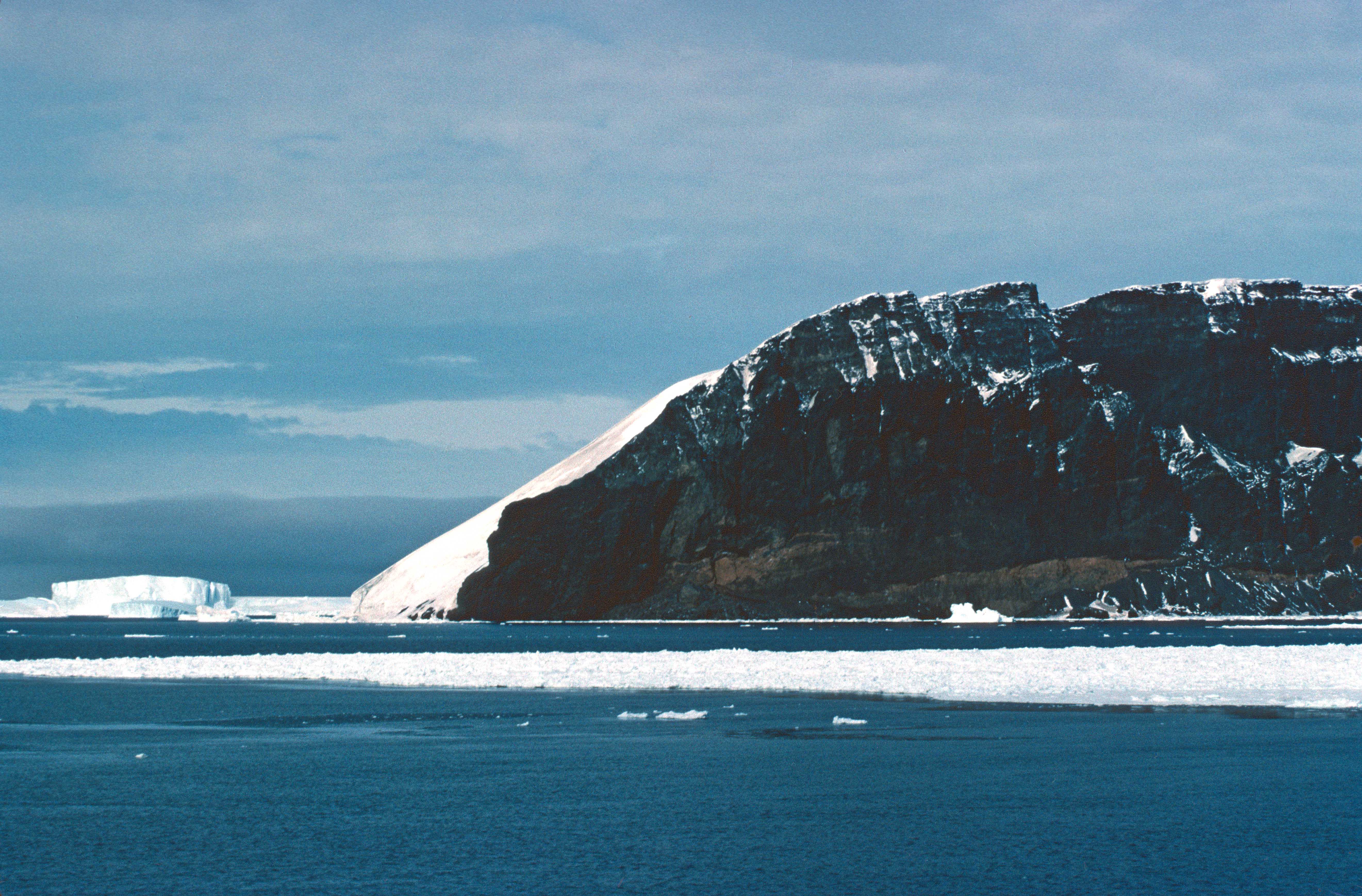
It was an extraordinary experience to sail along a coast of mountainous terrain, covered in glaciers going down into the sea (below).
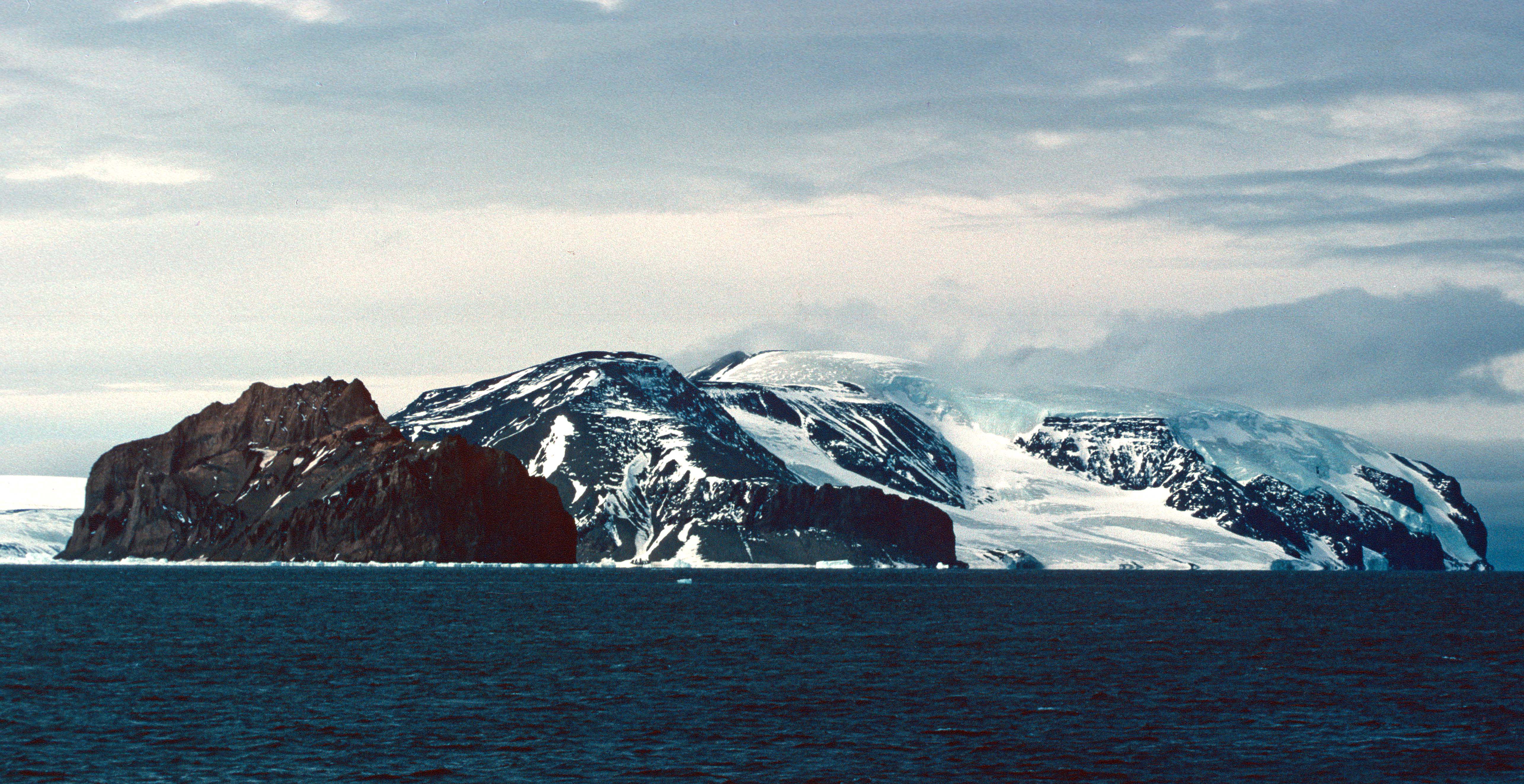
It was also a strange experience to sail along a coastline and know that there are no humans there, apart from a few tiny huts, research stations, at one or two locations.
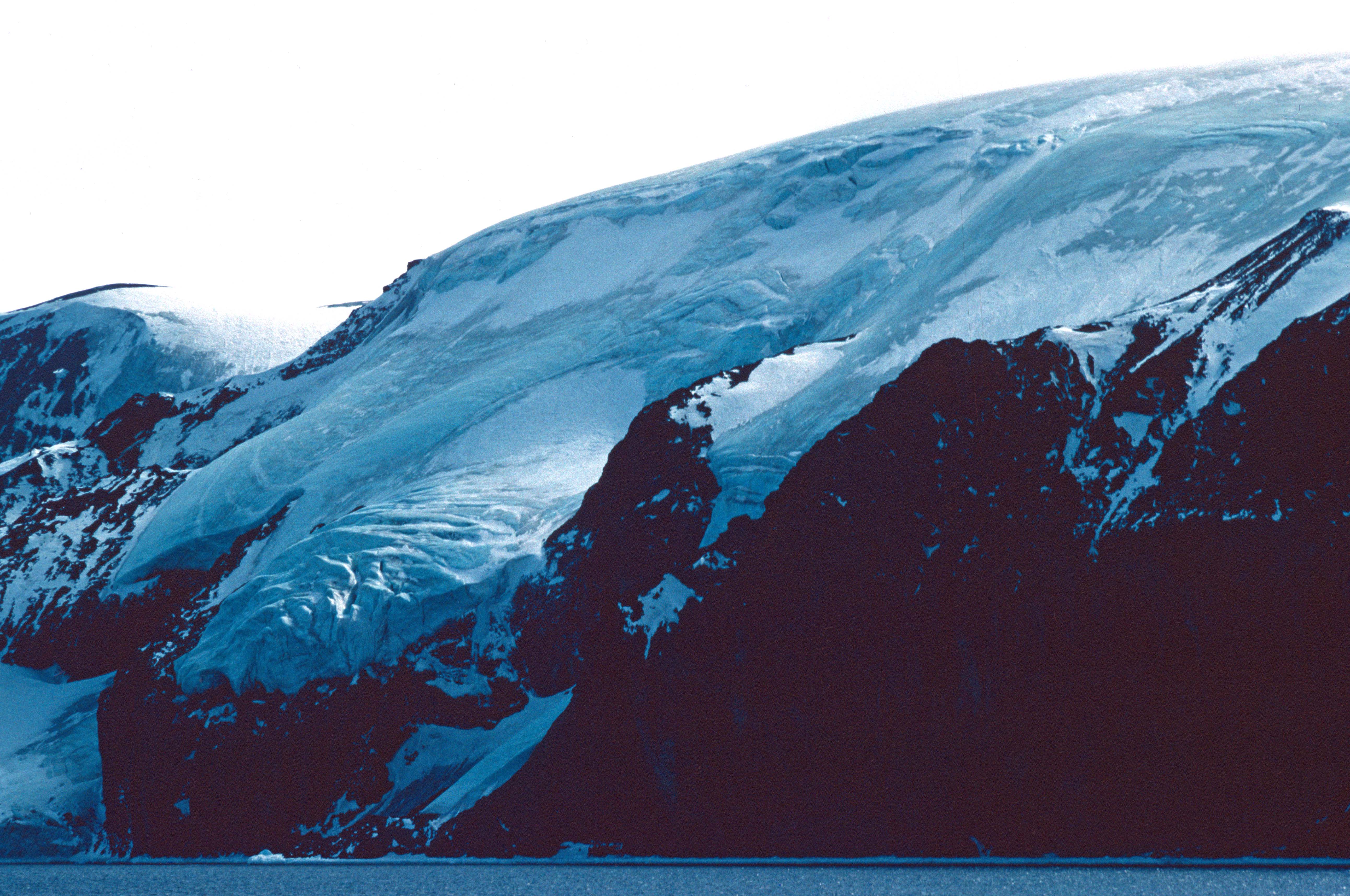
There were huge areas of exposed sedimentary rocks (below), replete with fossils no doubt, that make this area so geologically interesting.
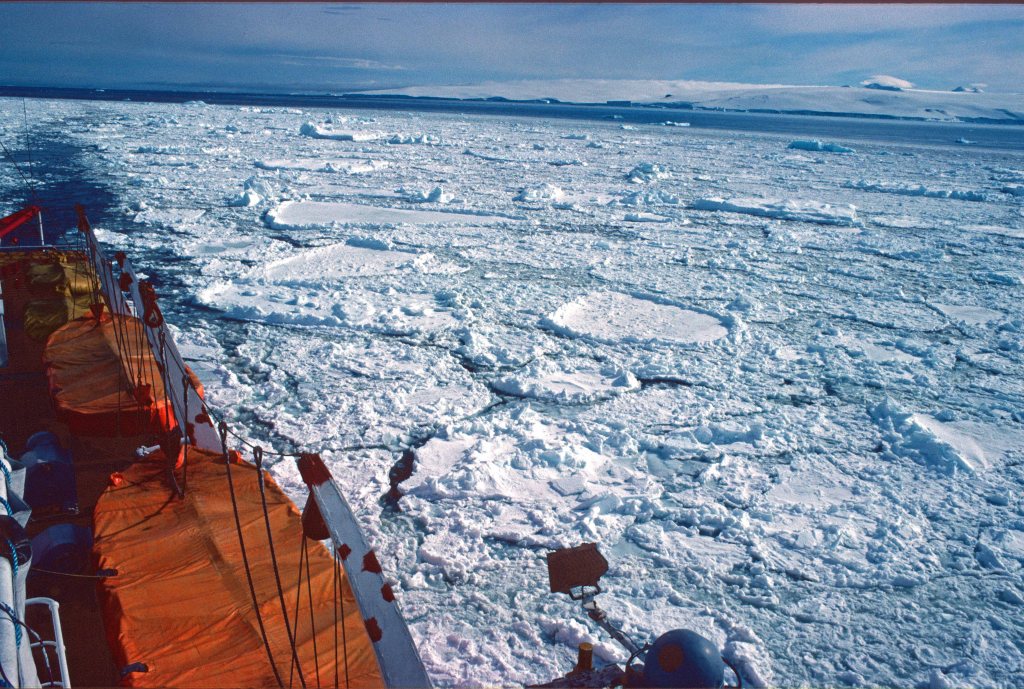
As we neared James Ross Island, we came up against loose pack ice. The sound of the ship moving through these pieces of ice is rather disconcerting: thump, thump, thump! But she was ice strengthened and perfectly capable of pushing through (below).

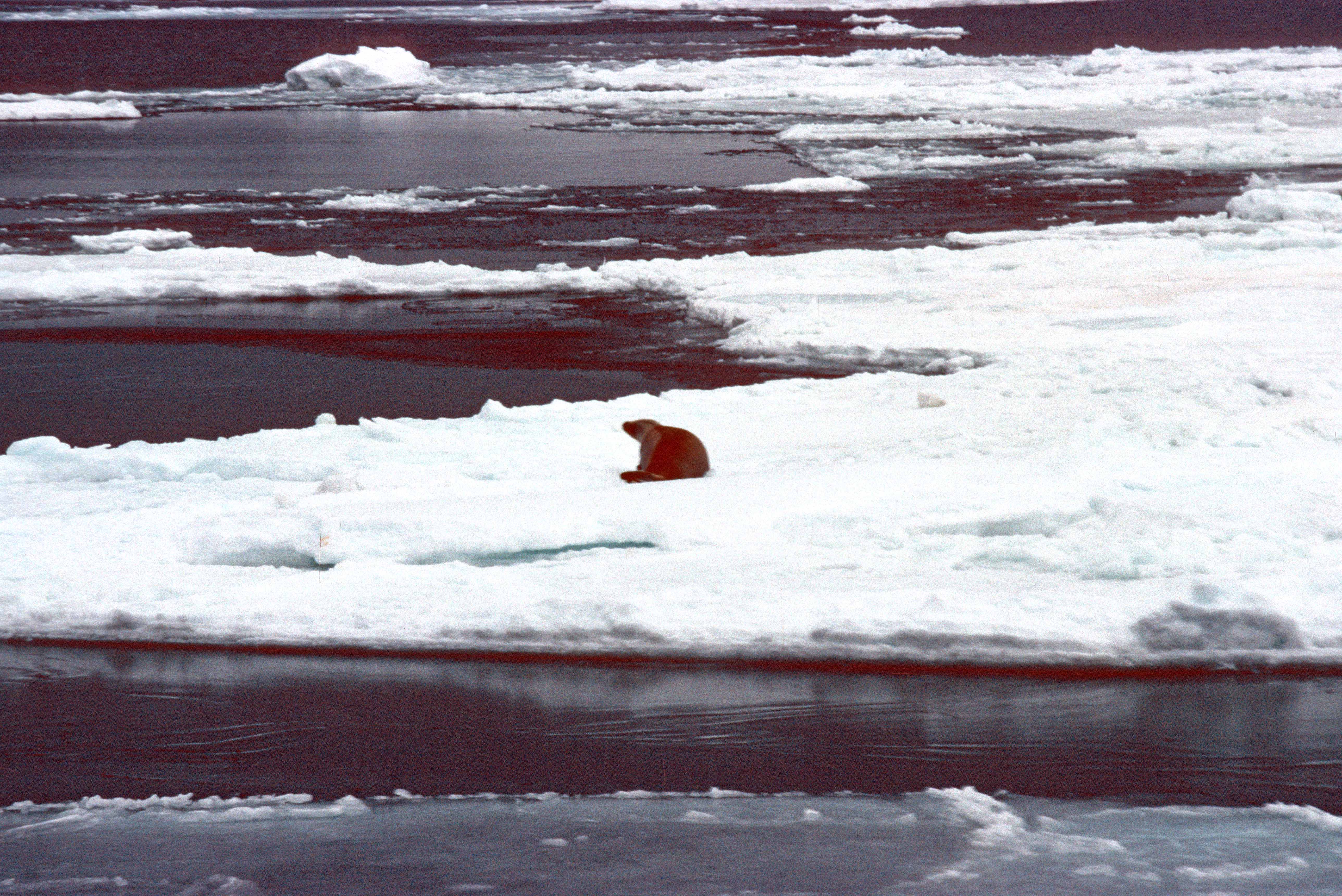
The odd crabeater seal was seen hauled up on an ice floe (below).
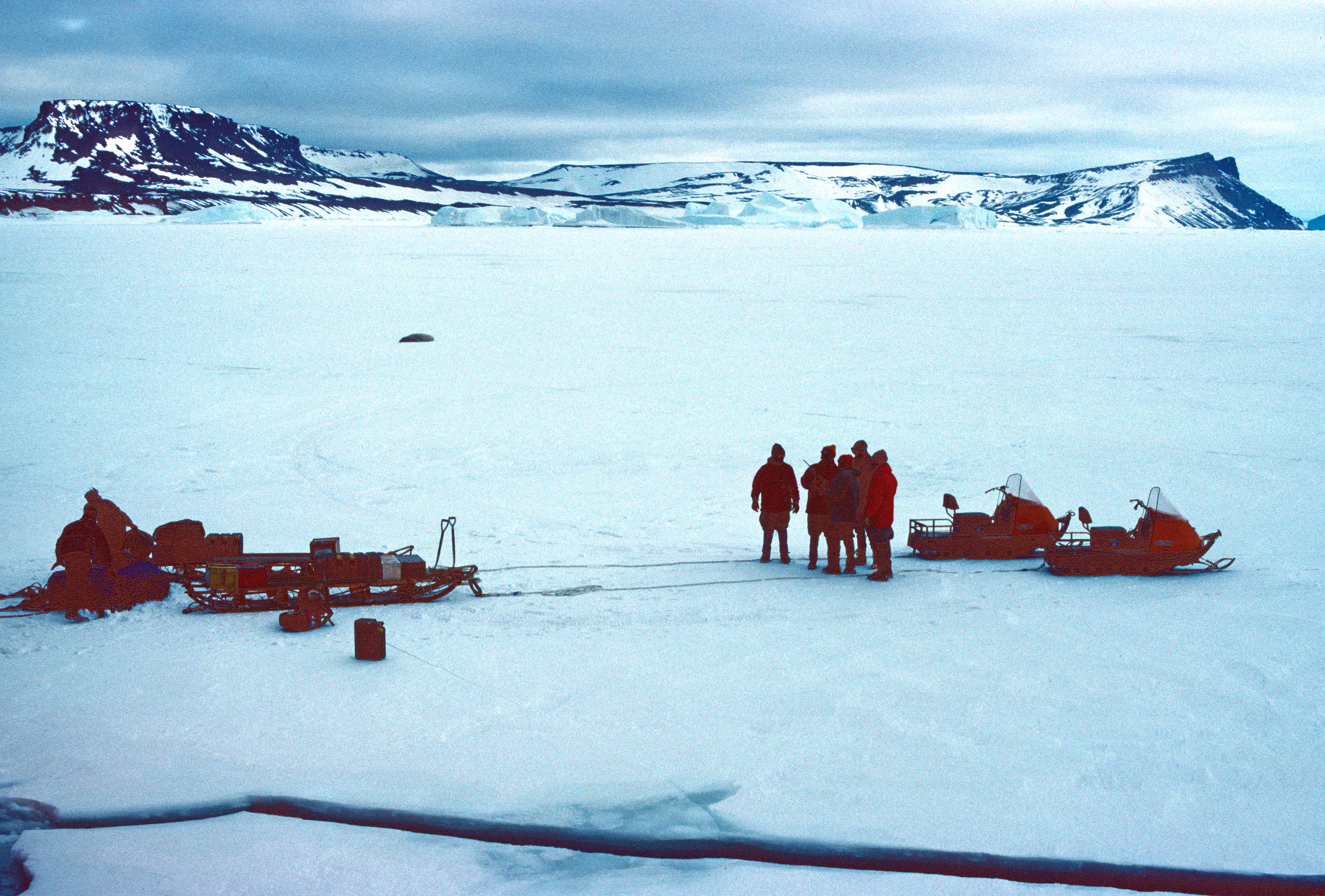
Eventually however, we came up to thick pack ice and could go no further. So, the geologists were deposited on the ice, together with their sleds and ski-dos, some 7 miles away from James Ross Island (below).
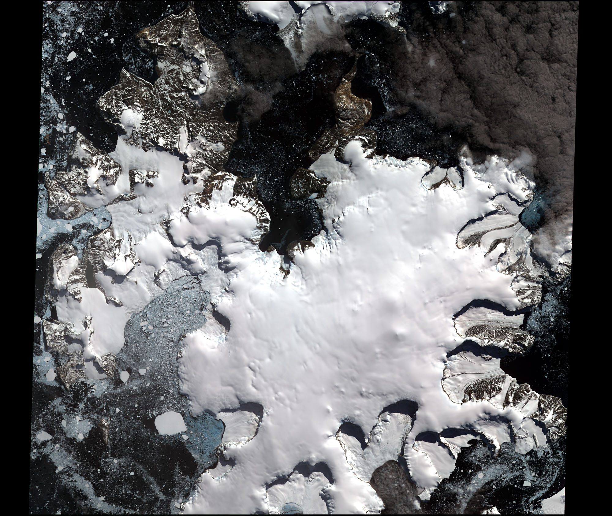
In 1982, James Ross Island was connected to the Antarctic Peninsula by the Prince Gustav Ice Shelf . However, this 15 nautical mile (28 km) tongue of ice retreated rapidly between 1989 and 1995, and finally collapsed in 1995 (below). It had gradually shrunk over time from an area of ice covering 2,000 square kilometers (in 1945), to 1600 sq km in 1957, to nothing , in 1995 (Cook & Vaughan, 2010).
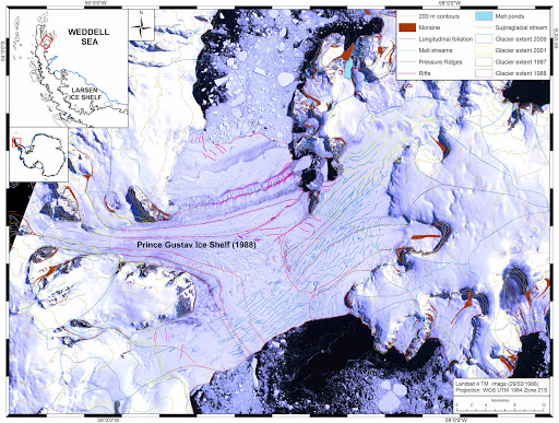
The Prince Gustav Ice Shelf is just one a number of glaciers (Jones, Wordie, Prince Gustav, Larsen A) that have totally disintegrated, i.e. collapsed within the last half-century in the Antarctic. So James Ross Island looks rather different today (photo taken in 2009, below) than it did in 1982.
There has been a steady decline in total area of the ice shelves that occur in the Antarctic Peninsula, that began in the 1970s (Cook & Vaughan, 2010), with the areas of ice decreasing by thousands of square kilometers, presumably as a result of global warming. These gone-forever ice shelves have been called ‘ghost-ice-shelves‘. There were there when the first Antarctic explores visited these lands – Nordenskjold was the first person to travel in this area in 1902 (Reece, 1950) – but they are starting to disappear. Slowly breaking off and melting into the sea, which has risen by about four inches, roughly, since I made this trip in 1982!
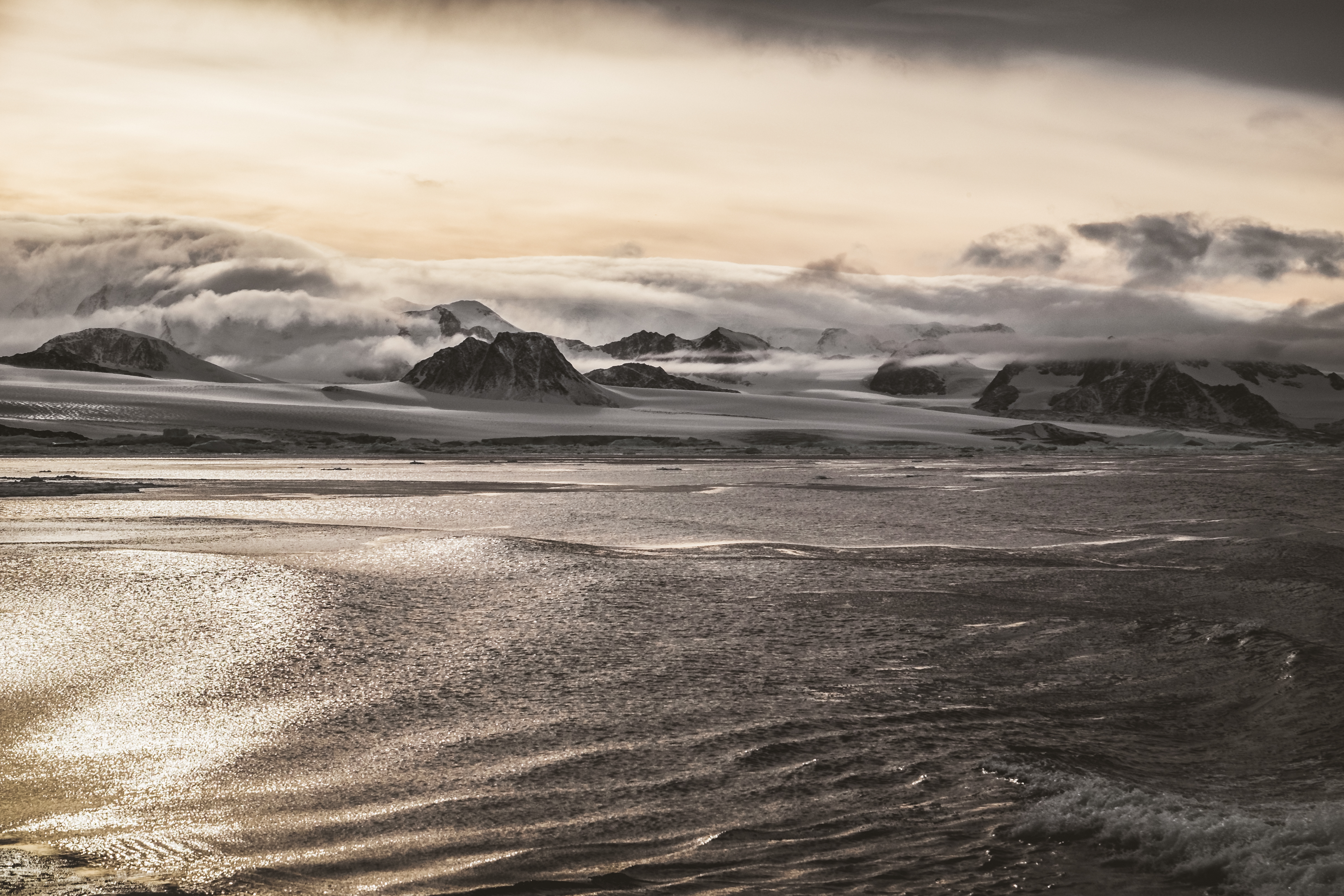
The following beautiful photograph of James Ross Island was taken during a NZAC (New Zealand Alpine Club, I think!) expedition to Antarctica in 2018. Other (modern!) photographs can be viewed here.
This part of the world is still very isolated and remote, although not quite as much so, as when I visited it in 1982. There are a few cruise ships which venture into the Weddell Sea and attempt to sail through the Prince Gustav Channel, and there is a Czech Antarctic Station (called Mendel) situated on James Ross Island, which was built in the years 2000–2006. So the Antarctic is gradually opening up to humans, but our presence is still very thin, thank God, and the animals – which I will illustrate in forthcoming blogs – mostly have it to themselves.
Link
https://blogs.ei.columbia.edu/2016/11/24/ghost-ice-shelves-and-the-third-antarctic-ice-sheet/
References
Cook, A. J., & Vaughan, D. G. (2010). Overview of areal changes of the ice shelves on the Antarctic Peninsula over the past 50 years. The cryosphere., 4(1), 77-98.
Cooper, A. P. R. (1997). Historical observations of Prince Gustav ice shelf. Polar Record, 33(187), 285-294.
Glasser, N. F., Scambos, T. A., Bohlander, J., Truffer, M., Pettit, E., & Davies, B. J. (2011). From ice-shelf tributary to tidewater glacier: continued rapid recession, acceleration and thinning of Röhss Glacier following the 1995 collapse of the Prince Gustav Ice Shelf, Antarctic Peninsula. Journal of Glaciology, 57(203), 397-406.
Reece, A. (1950). The ice of crown prince gustav channel, Graham land, Antarctica. Journal of Glaciology, 1(8), 404-409.

Leave a comment